WARNING
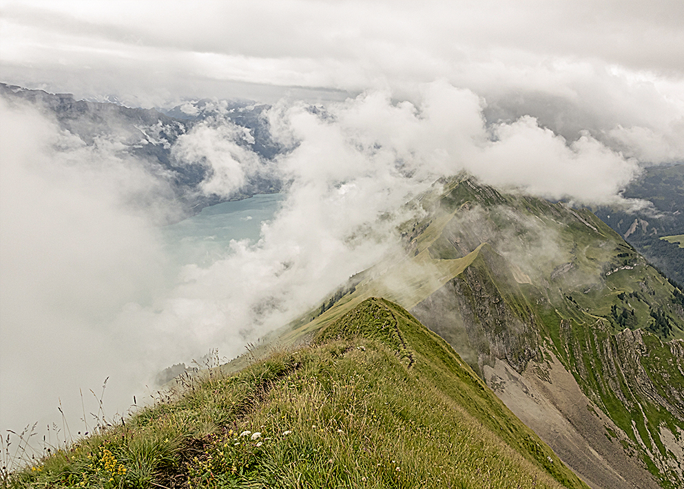
If you are an experienced hiker, with the right equipment, stamina and a head for heights, this trail and its risks will be difficult. Portions of this trail are rated T5 for a reason - they are very dangerous, and require a high level of experience and skill. It is certainly not for everyone, and if you have any doubts about your ability to deal with the risks of high vertical exposure on both sides while hiking a narrow path with significant elevation gain over six to nine hours, do not attempt it. This trek is only possible during the late spring, summer and early autumn seasons. Most of the peaks along the trail and many difficult and steep sections remain in shadow through autumn, winter and spring and are snow or ice covered from November until the end of May making them extremely dangerous or impassable. Please also note that the relatively 'easy' peaks of Suggiture and Augstmatthorn are very dangerous in early Spring and Late Autumn. If any snow is visible on the trails along the way to these peaks, there will be snow on the peaks, and that makes certain sections extremly difficult and dangerous. Many people think as the weather warms in the valley, a wander up to these mountains will be easy. It is not. Pay attention to the weather forecasts, check webcams in Habkern and at Brienzer Rothorn and watch for high winds in the forecast.
I prepared for the trek by hiking up to Augstmatthorn from Habkern, Interlaken and Harder Kulm a dozen times before attempting the full trail, and only then when the weather window was wide enough to accommodate seven to ten hours without rain, storm or serious wind. It is not a trail to be 'conquered' or entered into lightly. There are dozens of other amazing ridge trails in the area (Brienzer Rothorn to Turren, Brienzer Rothorn to Soerenberg/Planalp/Brienz, Schynige Platte to Grindelwald First, Niederhorn to Gemmelalphorn/Habkern, and more) that all offer incredible views and short and long choices when it comes to your time on the trail. This is an unmonitored, unofficial trail with portions that are white-blue-white Alpine Trails, meaning the difficulty level is very high. Accidents happen up here, and there are memorial markers in a number of places along the way to remind you of that fact. I have spent enough time up here to know that most people on the ridge know what they are doing, they have researched the trail and trained for it and they too approach it with respect and caution.
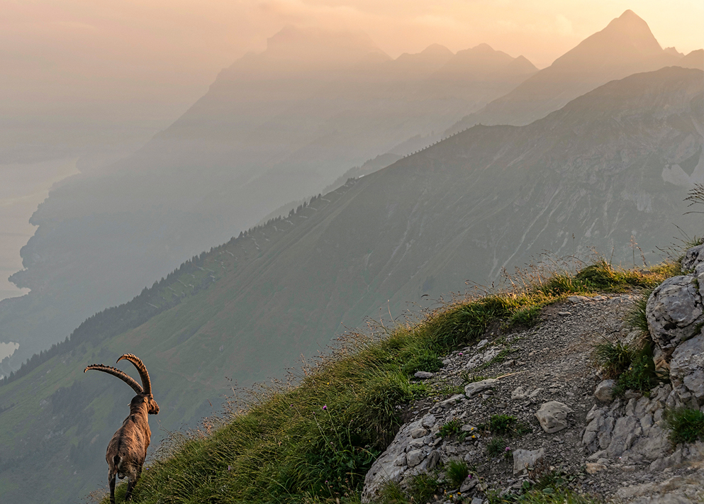
In the last few years I have witnessed a growing trend of hikers who plan to camp or fly drones up here. It is illegal. There is NO CAMPING AND NO DRONE FLYING allowed anywhere along the route. From Harder Kulm to Ällgäulücke the ridge and all peaks are a designated nature conservation area and protected area for Steinbock. From Ällgäulücke to Brienzer Rothorn forms the edge of the UNESCO Entlebuch Biosphere where again, no camping or bivouacking is allowed. Drone flying of any kind is prohibited along the entire ridge. Mountain bikes or vehicles of any kind are prohibited from the ridge and trails leading to and from the ridge because those trails are also in the federally protected wildlife area. Dogs must be kept on leads at all times in the protected area. Swiss Rangers and the Game Warden patrol the ridge regularly and fine illegal campers as well as removing them from the mountain at night. Please respect these beautiful places and stick to the trails and do not camp or fly drones up here, it disturbs the wildlife and is illegal!
I have recently started a community group called Friends of The Ridge with the goal of increasing awareness of the rules that protect this beautiful area. You can find out more about that here.
DO NOT UNDERESTIMATE IT. That really is the best advice I can give. 1100 vertical metres of total elevation gain (direction Brienzer Rothorn to Harder Kulm) doesn't sound a lot, but when you have to climb nine peaks in a row, each around 100 to 150 metres up and 100 to 150 metres down, it takes a serious toll, and requires serious effort and stamina to complete. About half of those ascents and descents also require actual climbing using all fours, not just walking. That often comes as a surprise to many hikers up here. There is no margin for error and there is no easy or short way to leave the ridge once you get going. At Ällgäulücke there are two exits from the ridge, down to Oberried am Brienzersee at the lake side (or back to Planalp and from there down to Brienz) and in the opposite direction across the meadows to Kemmeriboden. Depending on your direction, this does offer a solid place to consider if a: the weather will continue to hold for the remainder of your hike (3-4 hours additional in the direction of Harder Kulm; 3-4 hours additional in the direction of Brienzer Rothorn) and b: if you have the energy or supplies left to complete the ridge. And remember, just when you think you are done with the ridge, you still have to get off it and ALL the exits except for Brienzer Rothorn and Harder Kulm will take at least two, sometimes three hours, of punishing steep downhill. There's a steep route from Blasenhubel down to Oberried am Brienzersee, that's about 2-3 hours from the peak to the lakeside train station. Augstmatthorn and Suggiture also offer multiple exits from the ridge down to Niederried/Oberried am Brienzersee or down on the western flank to Lombachalp and Habkern. After that, there are exits down to Ringgenberg (via Graagetor or Roteflue paths) which also provide a good alternative to the long slog through the forest to Harder Kulm.
Take your time. Make sure you bring enough water (at least 2 litres each person, 3 if you can carry the weight) and food for a good 5-7 hours with no place to replenish supplies. Hike to Suggiture/Augstmatthorn from Harder Kulm, Habkern or Lombachalp or take the train or cable car up to Brienzer Rothorn and take a long look at the whole ridge. Once you see it in person, you'll get a better feel for its length and whether or not it looks like something you want to do. Never attempt it in heavy rain, or if heavy rain or storm is forecast between Brienz and Interlaken within the 7-9 hours it'll take to complete. Wind is of course a major factor, and that too must be considered on this very exposed ridge. I do not attempt the hike in forecast high winds, it is simply too dangerous on an exposed ridge. Always check the weather forecast daily before and the day of your planned hike. And make sure you check the forecast for the peaks (Augstmatthorn, Tannhorn at least) and not just the area.
I waited until almost all the snow had melted in the area along the ridge before attempting it, and still watch the weather carefully before every pass. I have completed the ridge over thirty times now in varying conditions from cold and wet to foggy to super clear and sunny. All present their own problems, but rain and muddy conditions are the most difficult I've encountered, so pay attention not just to the current/forecast weather, but also to the weather in the days preceding your hike. I have completed this ridge trail in both directions (from Brienzer Rothorn towards Harder Kulm and from Harder Kulm towards Brienzer Rothorn), and starting from Brienzer Rothorn is in my opinion the smarter way. It is almost half the vertical distance than going the opposite way (Harder Kulm to Brienzer Rothorn is an approximate total of 2,000 metres in vertical change, the opposite direction just over 1,100 metres of ascents). The most challenging part of these ascents either way, is that they are numerous, about nine distinct ascents each way. That is very tiring on a good day, and requires serious attention to the pace with which you approach this trek. NOTE: An additional safety factor here - Tannhorn is the most exposed section of the trail, particularly its northeastern flank. I have been up and down that mountain over thirty times in the last few seasons and I have to point out that you must be in absolute peak mental and physical condition to attempt it. If it is early in your trek (Brienzer Rothorn towards Harder Kulm) it is likely you are in much better shape to handle it than if approaching it from the other direction (Harder Kulm to Brienzer Rothorn). Both directions have their challenges, but if you are in any way tired or sore after a long hike, this stretch will not forgive any mistakes. The ascent is difficult and precarious, and not for those unexperienced with high alpine hiking. You can go around it (Ällgäulücke to Wannepass and vice versa) if you are too tired or wind/ground conditions make it too dangerous.
Also consider your timing because the last transport (cable car/train) down from the Brienzer Rothorn end is between 17.15 and 17.40, and at the Harder Kulm end the last funicular down to Interlaken is around 19.30/20.30 through most of the season. You have to factor in the time it will take you to get there without rushing to make the last transport. I usually plan for a safe (well-paced) nine to ten hours from Interlaken to Brienzer Rothorn all in and seven to nine hours all in from Brienzer Rothorn to Interlaken/Habkern.
If you have any doubts or concerns (weather window potentially too short, experienced friends can't make it, timing to reach the last transport off the mountain is tight, whatever) wait for another opportunity. Make sure you hike with someone who is experienced either with this ridge or with any high alpine hiking. Pace yourself and work out your exit options if weather or other unforeseen conditions mean you have to exit at Augstmatthorn or Ällgäulücke. More than anything, don't fuck around. Don't mess with the trail, don't go chasing Steinbock off the trail or seeking an amazing Instagram shot on portions of the ridge not on the trail. It isn't worth it. I have seen people running and jumping down Augstmatthorn to start this trail, and maybe they are able to do such things and sustain it for 6-8 hours. I can't. I know my limits. I have also seen tourist groups completely unequipped and unprepared for alpine hiking, particularly at the Harder Kulm-Augstmatthorn end of the trail. As the comparitively easier part, it is often underestimated, but does require a lot of climbing and regularly muddy and difficult terrain, good hiking footwear and layered clothing for potential change in weather conditions is essential. Respect the ridge, and your fellow hikers. Passing is often difficult up here, so be courteous and patient, no-one should feel hurried to 'get out of the way' as there often isn't a place to get out of the way. Do not leave any rubbish behind and if you are able to, pick up anything other people have carelessly left behind. Make sure you sign up for a Rega Patronage (Swiss Alpine Rescue Service), download their app and read their safe hiking tips before you start (before you start any alpine hike or climb): rega.ch/en/news/news-from-the-world-of-rega/detail/well-prepared-for-an-excursion-in-the-mountains.
If you have further questions about the Brienzergrat to Hardergrat trail, please ask me. I live at the foot of the ridge, and have hiked it over thirty times as well as hiked every route to and from the ridge from Oberried am Brienzersee, Niederried, Ringgenberg, Interlaken, Habkern, Brünigpass, Brienz and Brienzer Rothorn. I have often helped people complete the trail or exit safely when the need arises. I am up on the ridge or on nearby trails most weekends and would be glad to advise and guide. Just ask! And don't forget to buy my book! It is quite good (I have been told). :)
Finally, again, please respect the rules! NO CAMPING AND NO DRONE FLYING ALLOWED. Every season I count dozens of people camping or flying drones along the Brienzergrat to Hardergrat trail. I usually see one or two groups hiking with full camping gear every time I am up here and most times that I visit Augstmatthorn there's a drone buzzing somewhere around. It is illegal to camp ANYWHERE along this ridge. It is also illegal to fly drones anywhere along the ridge. There are clearly worded signs at every entry point to the ridge that state this but still people ignore the rules. The ridge is part of a protected area for Steinbock at the Augstmatthorn end, and from Tannhorn to Rothorn the ridge forms the edge of the Entlebuch Biosphere. There are clear signposts at both ends of the trail: No Camping. No Drone Flying. Mountain bikes are prohibited and dogs must be on their leads. Please consider the wildlife and the environment. The more people breaking rules up here, the less the Steinbock will return and the ridge becomes spoiled for all of us. Please visit hardergrat.com to find out more.